Hiking to Brunakseltinden

DifficultyMedium
LocationMoskenesøya
Duration3 hrs
Distance8.03 km
Climb600 m
Maximum altitude523 m
Map - 1:50 000Vest-Lofoten
Snow riskUntil May at the top
  • Type of hike : Go back
  • Visibility of the route : Good
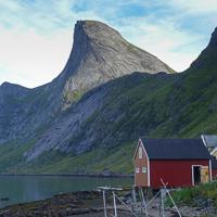
  • Start/Finish : Leave from the main wharf (landing stage) in Vinstad
  • GPS Point : Start/finish : N67 57.477 E13 00.229
Vinstad - Brunakseltinden
Description


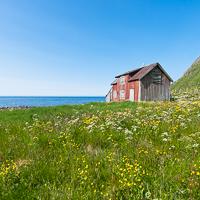
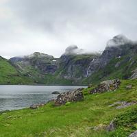
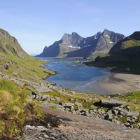
From the village of Vinstad, which can only be reached by boat, walk the length of the fjord along the village’s only street. At the end of the fjord take the trail on your left towards the Einangen pass.


More information about this hike...

Cover EN ptYou can read the detailed description of this hike (as well as 59 other hike descriptions), enjoy hundreds of photos, maps and practical information on the paper guidebook Hiking the LOFOTEN ISLANDS.
You'll find the guidebook on logo amazon en, as well as at the following bookstores, for 24,07£ (not including shipping).

Order on Amazon

Accessibility
No
No
No
Download the route
Brunakseltinden.gpx

Join the start of the hike with Google Maps

You can use your actual location or enter the name of the place from which you wish to start

Other hikes nearby

Hiking to Hermannsdalen

Hiking to Hermannsdalen

Located at 0.0 km
Moskenesøya
DifficultéMedium
13.9 km

Accessibility
No
Yes
No
Forsfjord to Vindstad

Forsfjord to Vindstad

Located at 2.2 km
Moskenesøya
DifficultéMedium
3.3 km

Accessibility
No
No
No
Hiking to Hermanndalstinden

Hiking to Hermanndalstinden

Located at 2.2 km
Moskenesøya
DifficultéDifficult
16.6 km

Accessibility
No
No
No
Hiking to Segltinden

Hiking to Segltinden

Located at 4.0 km
Moskenesøya
DifficultéDifficult
7.1 km

Accessibility
No
No
No

Copyright

Any representation whether total or partial of this site or content (general structure, texts, sound, logos, images whether animated or otherwise), by any method whatsoever, without the authors express prior approval is prohibited and constitutes infringement sanctioned by the Intellectual Property Code. The GPX tracks that can be downloaded on this website, bellong to hiking-lofoten and is for a private use only (not for commercial use). In order to reproduce the tracks in any form or on any medium (paper, digital, website, etc.), we ask you to mention the following (under or on the map): GPX track © hiking-lofoten.net