")


Hiking to Baken
 Medium / Difficult
 Austvågøya
 4:30 hrs
 10.57 km
 780 m
780 m 678 m
678 m Vågan
Vågan Until May in the upper part of the walk and on the summit
- Type of hike : Go back, Loop
- Visibility of the route : Non-existent
- Start/Finish : Next to the small power station of Kvitforsen, along Route 888 connecting Vestpollen to Strumnes, 1.5 km (0.9 mi.) after the Jordneset crossroads, you'll find a place to park in the left bend of the road facing the electric power plant. Be careful not to obstruct traffic or the access to the power plant.
- GPS Point : Starting point (parking lot): N68° 19.601' E14° 39.070'
Summit: N68° 20.368' E14° 37.547'
Stone hut: N68° 20.772' E14° 39.032' - Note : Careful! Some of the lakes have structures to retain water (dams or underwater catchment areas). It is dangerous to bathe in these lakes, especially near hidden catchment structures
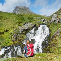
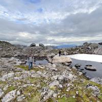
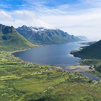
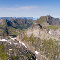
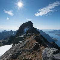
This hike is a real adventure that has lots of surprises for you! After a grueling start through rich vegetation on extremely steep slopes, you reach a peaceful valley with a succession of lakes and pastures, where half-wild sheep graze in season. The fine path you’ll find in the upper part of the valley was once used to construct a series of little dams and underground catchment areas that feed the electric power plant down below. Finally, despite the name Baken (which usually means a rounded hill in Norwegian), the summit is a real peak that gives you a striking view over this little-known part of the Lofotens.
More information about this hike...
|
|

 No
No No
No No
No
https://www.rando-lofoten.net/en/?Itemid=1337&option=com_content&lang=en-GB&view=article&id=569#sigProIddacf7004c3


Download the route |
Kvitfors_Baken.gpx |
Join the start of the hike with Google Maps
You can use your actual location or enter the name of the place from which you wish to start