")


Hiking to Blåtinden
 Easy / Medium
 Vestvågøya
 3 to 4 hrs
 5.62 km
 460 m
460 m 615 m
615 m Vestvågøy
 Until May at the summit
- Type of hike : Go back
- Visibility of the route : Good in the beginning, then medium
- Start/Finish : Coming from Leknes on the E10, approximately 1km before the hamlet of Borg (Viking museum), turn right onto a dirt track at the 'Slydalen' sign. Go back up the trail to the car park at the end of the valley. Remember that it may not be possible to drive on the road at certain times of year.
- GPS Point : Start/finish : N68° 13.072' E13° 48.017'
Summit : N68° 12.272' E13° 49.001'
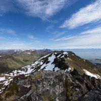
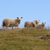
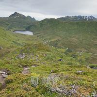
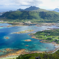
This is a short hike that does not pose any real problems. It begins in the Slydalen Valley where there are a few isolated farms and takes you to Blåtiden at altitude 604m. The peak is part of the range that overlooks Vestfjord and crosses the large island of Vestvågøya. A magnificent view awaits you at the peak: the fabulous panoramic view over the fjord to the south and the sea to the north gives the peak its name: Blåtiden (“blue peak”).
More information about this hike...
|

 No
No Yes
Yes Yes
Yes
https://www.rando-lofoten.net/en/?Itemid=939&option=com_content&lang=en-GB&view=article&id=311#sigProIdf9ecd5d2cc


Download the route | Blatinden.gpx |
Join the start of the hike with Google Maps
You can use your actual location or enter the name of the place from which you wish to start