Hiking to Kvittinden
 Medium
 Austvågøya
 4 to 5 hrs
 9.31 km
 748 m
748 m 681 m
681 m Vågan
Vågan until May on the top
- Type of hike : Go back
- Visibility of the route : good, poor to nonexistant
- Start/Finish : When you enter the village of Laupstad (coming from Svolvær), take the first road to your right, just after the big bend in the road (where you'll find a parking lot). Take the street for a hundred yards or so, then take a right into a dirt road that you'll follow to the end.
- GPS Point : Start/Finish : N68° 21.366' E14° 42.535'
Start of the sent toward Tverfjellet : N68° 21.977' E14° 42.455'
Summit : N68° 20.953' E14° 40.209' - Note : Kvittinden (“the white summit”, doubtless because it remains covered with snow late in the season) is a very common name in the Lofotens. Here, in fact, the second summit of the same name is only 5 km (3 mi) away. Be careful not to take the wrong summit: check the altitude on the map, which is quite different. Watch out for the inexistent electric line shown even on the most recent maps although it disappeared some time ago. Even if you can find traces of it if you really look (pieces of wood, cement), don’t count on it to find your bearings during the hike.
Description
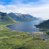
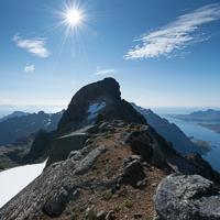
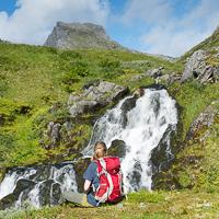
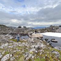
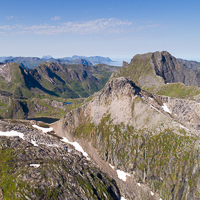
Few hikers come here, although the summit is relatively easy to reach and looks down over the magnificent fjord of Austnes. You can admire varied landscapes of high pastures, lakes and mountains all along the way. If you want to walk far from crowds of tourists, while looking at one of the most beautiful summits Austvågøya Island, don’t miss this magnificent hike.
Accessibility
 No
No Yes
Yes No
No
Slideshow

View the embedded image gallery online at:
https://www.rando-lofoten.net/en/?tmpl=component&print=1&Itemid=1609&option=com_content&lang=en-GB&view=article&id=697#sigProId2f2962c542
https://www.rando-lofoten.net/en/?tmpl=component&print=1&Itemid=1609&option=com_content&lang=en-GB&view=article&id=697#sigProId2f2962c542


Download the route |
Kvittinden.gpx |
Join the start of the hike with Google Maps
You can use your actual location or enter the name of the place from which you wish to start