Hiking to Tindstinden
 Medium / Difficult
 Moskenesøya
 3 to 4 hrs
 5.72 km
 600 m
600 m 472 m
472 m Vest-Lofoten
 Until June on the summit
- Type of hike : Go back
- Visibility of the route : Medium
- Start/Finish : Sorvagen village
- GPS Point : Start/finish: N67 53.426 E13 00.679
Summit : N67 53.280 E12 59.155
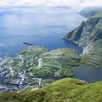
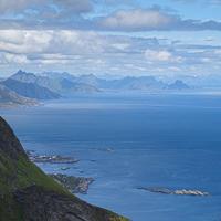
A short half-day hike that includes a fine view over A i Lofoten and Lake Agvatnet. You need to take care nevertheless as this route is only for experienced hikers who know to only tackle it when the path is completely free of snow and who have a good head for heights. As you leave Sørvågen, take the path leading to Munkebu (Munkan).
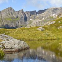
At the first pass (long: 13° 0" 26" - lat: 67° 53" 50") take the left-hand path and take the little wooden bridge over the outlet of Lake Stuvdalsvatnet. Follow the path that goes up a fairly broad ridge where you will find a number of tiny lakes.
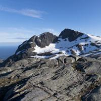
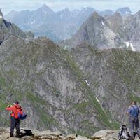
When you reach the end of the ridge turn left into the valley heading for the narrow pass on the right (the last few metres before the pass are steep). At the pass you will see a little path on the left which takes you to the summit. Return taking the same route.
 No
No No
No No
No
https://www.rando-lofoten.net/en/?tmpl=component&print=1&Itemid=774&option=com_content&lang=en-GB&view=article&id=210#sigProIded115cf2d8


Download the route | Tindstinden.gpx |
Join the start of the hike with Google Maps
You can use your actual location or enter the name of the place from which you wish to start