Hiking to Ballstadheia
 Medium
 Vestvågøya
 4 to 5 hrs
 7.5 km
 650 m
650 m 456 m
456 m Vestvågøy
 Until June at the top
- Type of hike : Loop
- Visibility of the route : Medium
- Start/Finish : Kraemmervika veien (behind the Havets Helter restaurant)
- GPS Point : Start/finish: N68 03.939 E13 32.045
Start from Graenvika: N68 03.792 E13 29.729
Nonstinden top: N68 04.316 E13 30.323 - Note : Not recommended if snowy or iced
Description
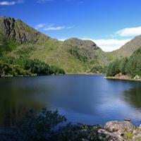
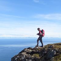
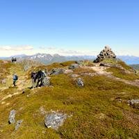
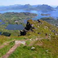
This pleasant hike around the back of the village of Ballstadlandet takes you around the Vestfjord along a narrow coastal path before reaching a cape and then climbing back along a steep path up to the plateau of Ballstadheia.
More information about this hike...
|

Accessibility
 Yes
Yes Yes
Yes No
No Slideshow

View the embedded image gallery online at:
https://www.rando-lofoten.net/en/ballstadheia-en?tmpl=component&print=1#sigProId2077ecd8d7
https://www.rando-lofoten.net/en/ballstadheia-en?tmpl=component&print=1#sigProId2077ecd8d7


Download the route | Ballstadheia.gpx |
Join the start of the hike with Google Maps
You can use your actual location or enter the name of the place from which you wish to start