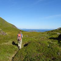
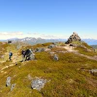
Hiking to Bulitinden and Guratinden
 Medium
 Vestvågøya
 5 hrs
5 hrs 9.88 km
 650 m
650 m 576 m
576 m Vestvågøy
 Until June on the top
- Type of hike : Go back
- Visibility of the route : Good
- Start/Finish : Nedreås Bus-stop (Route 997 - Ramviksveien)
- GPS Point : Start/finish : N68 07.415 E13 38.685
Pass : N68 07.463 E13 41.566
Bulitinden summit : N68 07.517 E13 41.962
Guratinden summit : N68 07.112 E13 41.358
Description
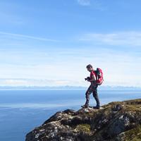
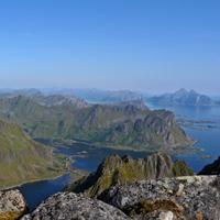
Although these two beautiful peaks above the town of Leknes (Vestvagoya) are easy to climb, they offer a spectacular panorama of the central part of the Lofoten Islands.
More information about this hike...
|

Accessibility
 Yes
Yes Yes
Yes Yes
Yes Slideshow

View the embedded image gallery online at:
https://www.rando-lofoten.net/en/guratinden-en?tmpl=component&print=1#sigProId646609637f
https://www.rando-lofoten.net/en/guratinden-en?tmpl=component&print=1#sigProId646609637f


Download the route | Guratinden.gpx |
Join the start of the hike with Google Maps
You can use your actual location or enter the name of the place from which you wish to start