Hiking to Haveren

DifficultyMedium / Difficult
LocationVestvågøya
Duration5 to 6 hrs
Distance8.03 km
Climb860 m
Maximum altitude793 m
Map - 1:50 000Vestvågøy
Snow riskJune at the top
  • Type of hike : Return trip or loop (depending on your itinerary choice)
  • Visibility of the route : Poor to unexisting
  • Start/Finish : The hike leaves from the small village of Bø (along the 996 road ' Careful! several hamlets in the Lofoten Islands have the same name!). When you come from the south, park in the parking area on the right, just before the small bridge that crosses the stream. The most direct trail is not really visible but it starts just before the bridge and passes through a little forest of birch trees.
  • GPS Point : Start/Finish : N68 19.202 E13 54.897
    Summit : N68 17.886 E13 56.857
    Crossing to Sletthaveren : N68 18.341 E13 55.873
haveren2
Description


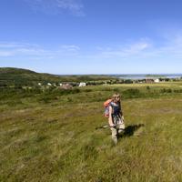
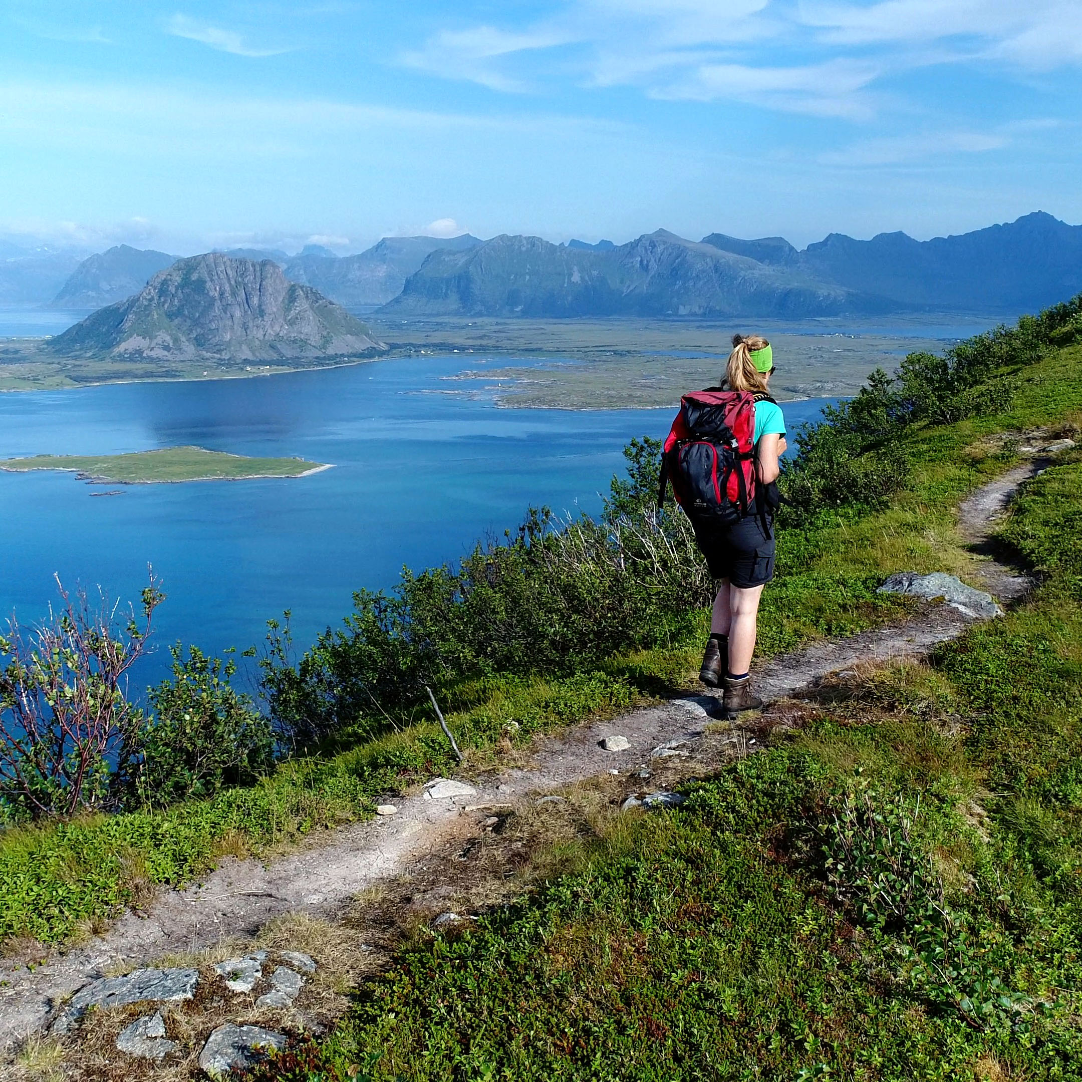
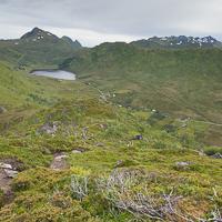
This beautiful isolated mountain range stands to the north-west of the island of Vestvågøya, a little off the main E10 road. Hikers here are few and far between despite the fact that the area is very beautiful and offers a wide range of panoramic views. The hike is possible either as a return trip or in a loop returning via the north shore of Lake Dalvatnet.


More information about this hike...

Cover EN ptYou can read the detailed description of this hike (as well as 59 other hike descriptions), enjoy hundreds of photos, maps and practical information on the paper guidebook Hiking the LOFOTEN ISLANDS.
You'll find the guidebook on logo amazon en, as well as at the following bookstores, for 24,07£ (not including shipping).

Order on Amazon

Accessibility
No
Yes
No
Slideshow
View the embedded image gallery online at:
https://www.rando-lofoten.net/en/haveren-en#sigProId12c86f2ef5
 
Download the route
Haveren.gpx

Join the start of the hike with Google Maps

You can use your actual location or enter the name of the place from which you wish to start

Other hikes nearby

Hikking to Middagstinden

Hikking to Middagstinden

Located at 3.1 km
Vestvågøya
DifficultéMedium
8.9 km

Accessibility
No
No
No
Hiking to Finnkjerka

Hiking to Finnkjerka

Located at 7.9 km
Vestvågøya
DifficultéEasy / Medium
10.1 km

Accessibility
Yes
Yes
No
Hiking to Hellostinden

Hiking to Hellostinden

Located at 8.6 km
Vestvågøya
DifficultéEasy / Medium
8.5 km

Accessibility
Yes
Yes
No
Hiking to Håtinden

Hiking to Håtinden

Located at 8.6 km
Vestvågøya
DifficultéMedium / Difficult
9.7 km

Accessibility
No
No
No

Copyright

Any representation whether total or partial of this site or content (general structure, texts, sound, logos, images whether animated or otherwise), by any method whatsoever, without the authors express prior approval is prohibited and constitutes infringement sanctioned by the Intellectual Property Code. The GPX tracks that can be downloaded on this website, bellong to hiking-lofoten and is for a private use only (not for commercial use). In order to reproduce the tracks in any form or on any medium (paper, digital, website, etc.), we ask you to mention the following (under or on the map): GPX track © hiking-lofoten.net