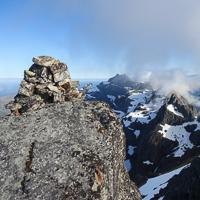
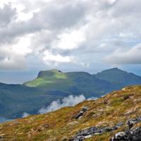
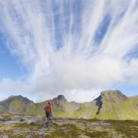
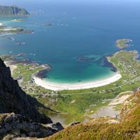
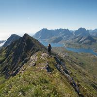
Hiking to Blåfjellkammen (Blåmannen)
 Medium
 Flakstadøya
 3 to 4 hrs
 7.39 km
 544 m
544 m 489 m
489 m Vest-Lofoten
 Until May at the summit
- Type of hike : Go back
- Visibility of the route : Medium/poor
- Start/Finish : Youth house facing the stockfish racks at the entrance of Skjellfjordenon the right hand side of the road (N68° 03.909' E13° 14.237')
- GPS Point : Start/finish: N68° 03.909' E13° 14.237'
Summit: N68° 02.449' E13° 13.029'
Description
Route proposed par Halfdan Holm
You park your car at the youth-house in Skjellfjorden and follow the clear path near a small shelter up to Nesheia. Here the path continues up to Volandstinden, so you’ll have to start following the GPX-track south towards Blåfjellkammen.
Now you can stop at (N68° 02.830' E13° 13.126') if you don’t have a head for heights, because you will actually only gain two extra meters by continuing on the edge. But it is a very nice edge, so if you have the time is it very much recommended to take the extra trip. Same way back.
Accessibility
 No
No No
No No
No Slideshow

View the embedded image gallery online at:
https://www.rando-lofoten.net/en/hiking-to-blamannen?tmpl=component&print=1#sigProId0d6c02fb38
https://www.rando-lofoten.net/en/hiking-to-blamannen?tmpl=component&print=1#sigProId0d6c02fb38


Download the route | Skjellfjord-Blafjellkammen.gpx |
Join the start of the hike with Google Maps
You can use your actual location or enter the name of the place from which you wish to start