")


Hiking to Håheia
 Easy / Medium
 Værøya
 3 hrs
3 hrs 5.69 km
 450 m
450 m 441 m
441 m Vest-Lofoten
 Until March
- Type of hike : Loop
- Visibility of the route : Good to fair in places
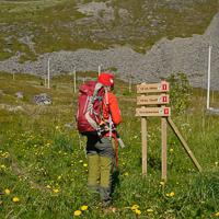
- Start/Finish : Leaving from the village of Værøy, take the little road toward Sørland (behind the village). The road passes on the left of a big boggy plain shown by blue hatching on the map. At the end of the road, you'll find a crossroad with the beginning of the track that leads to the beach of Sørlandshagen on one side and the road leading to the NATO radar station on the other.
- GPS Point : Starting point: N67° 40.343' E12° 39.485', parking lotStarting point: N67° 40.343' E12° 39.485' (parking lot)
Pass: N67° 40.710' E12° 38.559'
If extension:
Summit of Hornet: N67° 40.804' E12° 38.966'
Summit of Håheia plateau: N67° 40.000' E12° 37.909'
Radar station: N67° 39.775' E12° 37.591'Pass: N67° 40.710' E12° 38.559'
Summit of Hornet (if extension): N67° 40.804' E12° 38.966'
Summit of Håheia plateau: N67° 40.000' E12° 37.909'
Radar station: N67° 39.775' E12° 37.591' - Extensions : Summit of Hornet, medium; 4 hrs; 6,4 km; ± 550 m, max altitude 438 m
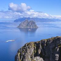
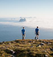
The summit of Håheia (438 m). is the second highest peak on the island of Værøy. It is also the only peak in the archipelago that has a road. It is private and leads to a NATO radar installation. Outside of this little bit of civilization, the wide open landscapes you’ll go through are magnificent. If the weather is clear at the top, you can admire the southeast of the Svartisen glacier, which is 120 km (75 mi). away on the Norwegian continent. This hike is easy and accessible to all. If you have time, you can extend it a little, to the summit of Hornet.
More information about this hike...
|
|

 Yes
Yes Yes
Yes No
No
https://www.rando-lofoten.net/en/hiking-to-haheia#sigProId39f9191e07


Download the route |
Haheia.gpx |
Join the start of the hike with Google Maps
You can use your actual location or enter the name of the place from which you wish to start

Download the route | Hornet_ext.gpx |