Hiking to Offersoykammen
 Easy
Easy Vestvågøya
 30 to 2 hrs
 2.54 km
 436 m
436 m 427 m
427 m Vestvågøy
 Until May on the summit
- Type of hike : Go back
- Visibility of the route : Good
- Start/Finish : The trail starts on the right along the E10 road coming from Leknes, approximately 900m after the bridge that spans Offersoystraumen.
- GPS Point : Start/Finish: N68° 09.266' E13° 30.836'
Summit: N68° 09.667' E13° 30.109'
Description
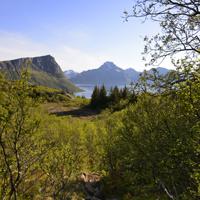
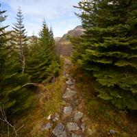
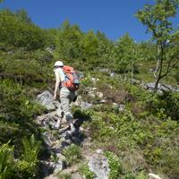
This small peak near Leknes on the peninsula of Offersøya is where a certain number of runners from the neighbouring town meet, you often see them jogging on the trail! Even though the altitude at the top is less than 450m, the panoramic view it offers is fantastic.
More information about this hike...
|

Accessibility
 Yes
Yes Yes
Yes No
No Slideshow

View the embedded image gallery online at:
https://www.rando-lofoten.net/en/offersoykammen-en?tmpl=component&print=1#sigProId78f7495c6d
https://www.rando-lofoten.net/en/offersoykammen-en?tmpl=component&print=1#sigProId78f7495c6d
Video


Download the route | Offersoykammen.gpx |
Join the start of the hike with Google Maps
You can use your actual location or enter the name of the place from which you wish to start