")


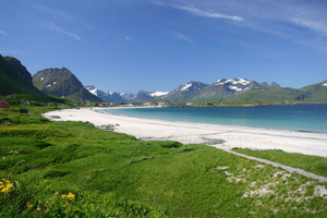
The Lofoten Islands , like a large stretch of the west coast of Norway, enjoy an exceptional climate. At this latitude, without the warm currents of the Gulf Stream the islands would be covered with ice and no vegetation could grow. In fact the warm marine currents from the North Sea give the archipelago a mild oceanic climate with average temperatures in January of 1°C in Røst to the south of the islands (in other words higher than those in mainland France at the same time of year) and cool summers with an average of 13°C in July.
Even though the temperature may occasionally rise to 30°C in July, it is common to have fine days with temperatures of 25°C during the three summer months.
But, attractive as the climate may seem, remember you are in an arctic region near the North Pole and temperatures can drop suddenly, which is why you need appropriate protective clothing (see Equipment).
I would now like to set the record straight regarding certain misconceptions about rain. Having spent every summer in the Lofoten Islands in the last ten years, as well as the ten previous years in the south-west of Norway, I can assert that, contrary to certain rumours, it does not rain constantly in the Lofoten Islands!
 In the summer it is not unusual to go 10 days without a single drop of rain. But once again, you have to be prepared for the weather to change quickly. The closeness of the sea and very mountainous landscape of the islands mean that the weather may be different from one place to another on the Lofoten Islands. It is therefore not unheard of for it to be sunny on the east coast and raining on the west coast ten kilometres away, or the other way round!
Rainproof clothing is vital in order to make the most of this wonderful place.
To sum up, you should expect an oceanic climate similar to that of Brittany with beautiful sunny days and mild temperatures that may be interspersed with cooler showery periods. The driest period is generally June, the hottest being July and August.
Weather Statement for Svolvær (1961-1990)
| Month | jan. | feb. | mar. | apr. | may | jun. | jui. | agu. | sep. | oct. | nov. | dec. | Year | |
| Average temperature (°C) | -1,5 | -1,8 | -0,3 | 2,2 | 6,5 | 10,1 | 13,0 | 13,0 | 9,0 | 5,2 | 1,8 | -0,5 | 4,7 | |
| Rain (mm) | 159 | 134 | 112 | 88 | 63 | 67 | 87 | 94 | 146 | 210 | 160 | 180 | 1500 | |
Source : Meteorologisk institutt
Weather Statement for Røst (1961-1990)
Month | jan. | feb. | mar. | apr. | may | jun. | jul. | agu. | sep. | oct. | nov. | dec. | Year |
Average temperature (°C) | 1,0 | 0,8 | 1,5 | 3,1 | 6,2 | 8,9 | 11,2 | 11,4 | 9,2 | 6,5 | 3,7 | 1,7 | 5,4 |
Rain (mm) | 77 | 60 | 59 | 45 | 32 | 35 | 48 | 52 | 79 | 100 | 84 | 89 | 760 |
Source : Meteorologisk institutt