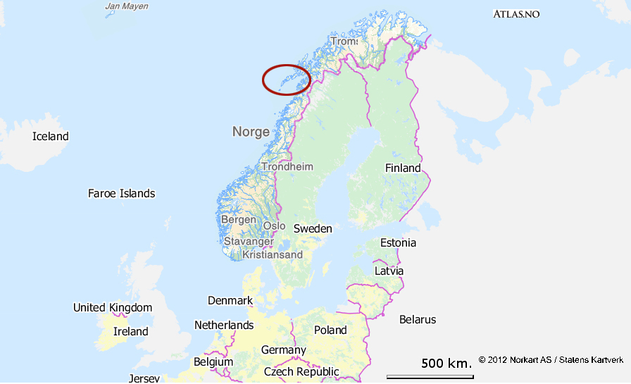
The Lofoten Islands belong to Norway and form an archipelago 300 km to the north of the Arctic Circle. The archipelago extends from the 67th to the 69th parallels and is roughly 150 km long. It is about fifty km west of mainland Norway.

 
(©norkart AS - Atlas.no)
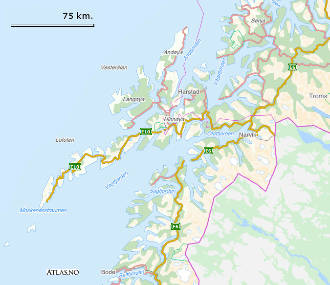
The archipelago is made up of seven main islands that are permanently inhabited and connected to the mainland by bridges. On the other hand, Værøy and Røstland to the extreme south can only be reached using the regular ferry services. 


The archipelago is separated from the Norwegian mainland by Vestfjord, a gigantic fjord (90 km wide at the mouth) which ends in Narvik 300 km further north. The widest part of Vestfjord to the south of the Lofoten Islands resembles an inland sea.

(©norkart AS - Atlas.no)

Despite being relatively close to the mainland the archipelago has always been isolated from the rest of Norway due to its location in the extreme north of the country, which is barely inhabited,  but also because the storms in Vestfjord, which are both violent and unpredictable, make access difficult. For the last ten or so years the Lofoten Islands, other than Værøy and Røstlandet, have been connected to the mainland via bridges and tunnels. Kong Olavs veien (or E10 road) has been the focus of a huge building project that has maintained the economic development of the islands, thereby preventing rapid depopulation while being environment friendly because much of the road goes underground or under the sea!
There are also three small airports with regular flights to and from the mainland as well as regular ferry and boat services that operate between the islands and the mainland every day.

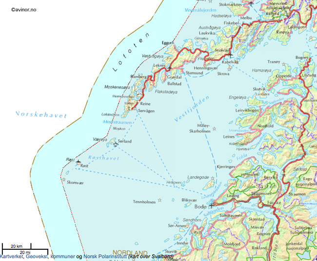
(carte aéroports et lignes de ferry ©avinet.no - norgeskart.no)

area  1 227 km2
coordinates  68° 10" 00" N 13° 45" 00" E
population  24 000 hab. approximately (in 2012)
population Density  19 hab./km2
main islands  Austvågøya, Gimsøya, Vestvågøya, Flakstadøya, Moskenesøya, Værøy, Røstlandet
administrative capital  Svolvær (Austvågøya)
language  Norwegian (Bokmål and Nynorsk)
foreign language  English


Svolvær (Austvågøya)

Search the site ...

Connection

In order to access certain services available on our site, (participation in forums, access to hiking sheets) you must register.

Our tips

Where to sleep, eat, drink and more in the Lofoten Islands

As we are not a tourist office, we will only publish recommandations for places we think are hikers and backpackers friendly and that we have tested AND appreciated. This section will get more stuff as we go along.

Latest news

 Visitor statistics

161,424 users, 24,000 subscribers and over 1,500,000 pages viewed in 2018!

To find out more about all the Rando-Lofoten visitor statistics with accurate data from Google Analytics, click here

 Increasingly accurate maps!

The Day Walks section has been improved thanks to the work of Frank Ingermann and the fantastic vector map background of Norgeskart.no (Norwegian Mapping Authority - Karverket). Hiking-Lofoten offers hiking guides that are getting ever more accurate and professional. Come and find out about them!

norgeskart-


Download the official Lofoten Islands maps

Lofoten Islands maps, scale 1:50 000 (UMT33)  download them for free on hiking-lofoten!Maps from the Norwegian National Institute of Cartography (Kartverket) are available in high definition (Tiff) on a set of ten maps.  Essential to prepare your hikes in the Lofoten Islands...

Lofoten maps

Northern lights forecast

Discover aurora forecast for Lofoten islands, thanks to NOAA POES satelitte from the "National Oceanic and Atmospheric Administration"

GPS routes

  • The GPS hiking routes are finally available as free downloads from the Hikes section!
  • Discover eight new routes in the Lofoten Islands with detailed Topos from Rando-Lofoten.

Day Length in the Lofoten

The Lofoten archipelago is located above the Arctic Circle, the result of this situation is a period of permanent days in summer and at the opposite a period of permanent night in winter (polar night).

To organize properly your trips and expedition in this region, it is important to take this phenomenon into account due to the high latitude. Discover our sunset/sunrise calendar

Copyright

Any representation whether total or partial of this site or content (general structure, texts, sound, logos, images whether animated or otherwise), by any method whatsoever, without the authors express prior approval is prohibited and constitutes infringement sanctioned by the Intellectual Property Code. The GPX tracks that can be downloaded on this website, bellong to hiking-lofoten and is for a private use only (not for commercial use). In order to reproduce the tracks in any form or on any medium (paper, digital, website, etc.), we ask you to mention the following (under or on the map): GPX track © hiking-lofoten.net