")


Hiking to Geitgallien
 Difficult
 Austvågøya
 7 hrs
7 hrs 9.99 km
 1116 m
 1094 m
 Vågan
Vågan Until end of Jully
- Type of hike : Go back
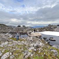
- Visibility of the route : Poor to nonexistant
- Start/Finish : When coming from Svolvaer on the road E10, drive to the village of Laupstad and cross it, then take the direction of Liland. Near the place called "Skinvollen", you will find an abandoned store, on the right hand side of it, you will reach a red-painted barrier, the path starts on the other side.
- GPS Point : Start/finish : N68 20.944 E14 44.668
Rocky edge : N68 20.920 E14 47.747
Pass on the top of the last scree : N68 20.730 E14 48.777
Summit : N68 20.662 E14 48.786 - Note : The trail is going though unsteady scree, risks of rockslides in the last part. Be careful, it is easy to lose the trail.
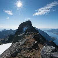
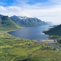
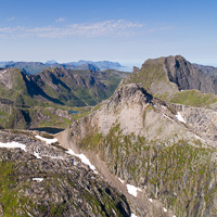
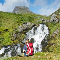
Geitgallien is the second highest peak in the Lofoten islands after Higravtindan which is only 61 m higher! But apart from this record altitude it is nevertheless one of the most beautiful peaks in the Lofoten archipelago. Combining an alpine landscape with fantastic views over one of the most rugged regions of the islands. Experience of mountain hiking and good weather conditions are indispensable if you are to reach the top safely.
More information about this hike...
|
|

 No
No No
No No
No
https://www.rando-lofoten.net/en/hiking-to-geitgallien#sigProIdb8140477e9


Download the route |
Geitgallien.gpx |
Join the start of the hike with Google Maps
You can use your actual location or enter the name of the place from which you wish to start