")


Hiking to Storknubben
 Easy
Easy Gimsøya
 3:30 hrs
 5.26 km
 600 m
600 m 613 m
613 m Vestvågøy, Vågan
 Until May on the summit
- Type of hike : Go back
- Visibility of the route : Good
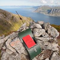
- Start/Finish : Approximately 200 m after the start of the path leading to Jenndalen farm.
- GPS Point : Start/finish: N68° 17.764' E14° 10.366'
Description
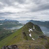
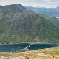
For once in the Lofoten Islands this route is clearly marked from the beginning up to the peak without any particularly demanding sections. This hike is possible for entire families and despite the fact that it is not particularly high, there are magnificent views along the entire route.
More information about this hike...
|
|

Accessibility
 Yes
Yes Yes
Yes Yes
Yes
Slideshow

View the embedded image gallery online at:
https://www.rando-lofoten.net/en/hiking-to-storknubben#sigProId4067fc923a
https://www.rando-lofoten.net/en/hiking-to-storknubben#sigProId4067fc923a


Download the route |
Storknubben.gpx |
Join the start of the hike with Google Maps
You can use your actual location or enter the name of the place from which you wish to start


Other hikes nearby
Hiking to Sundklakktinden and Skjolden
Located at 4.0 km
Gimsøya Medium / Difficult7.4 km
Accessibility
NoNoNo