")


Hiking to Moltinden (Flak)
 Medium / Difficult
 Flakstadøya
 4:30 hrs
 4.28 km
 700 m
700 m 681 m
681 m Vest-Lofoten
 Until May on the summit
- Type of hike : Go back
- Visibility of the route : Medium (poor on the second part)
- Start/Finish : Park in the centre of the village of Ramberg in the "Bunnpris" supermarket car park. Take the path opposite the cark park. This leads to the big round reservoir you can see from the car park. The track starts from the other side of the reservoir.
- GPS Point : Start/finish: N68 05.370 E13 13.745
Summit: N68 05.288 E13 15.570
Description
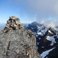
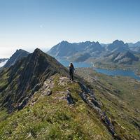
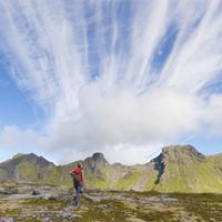
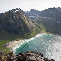
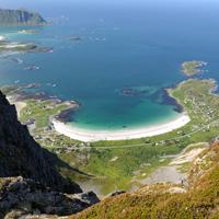
This short, strenuous hike takes you from sea-level to an altitude of 700 m in approximately 2 km. The route is steep! The view from the top is extraordinary because it gives onto both the Norwegian Sea and the mountain peaks to the south of the islands.
More information about this hike...
|

Accessibility
 No
No No
No No
No Slideshow

View the embedded image gallery online at:
https://www.rando-lofoten.net/en/moltinden-en#sigProIdd1064af72b
https://www.rando-lofoten.net/en/moltinden-en#sigProIdd1064af72b


Download the route | Moltinden_Ramberg.gpx |
Join the start of the hike with Google Maps
You can use your actual location or enter the name of the place from which you wish to start