 We recently came across an article by the Norwegian Ornithological Federation (NOF) reproduced by the local Lofoten federation (Lofoten Lokallag) and it seemed important to share it with you here.
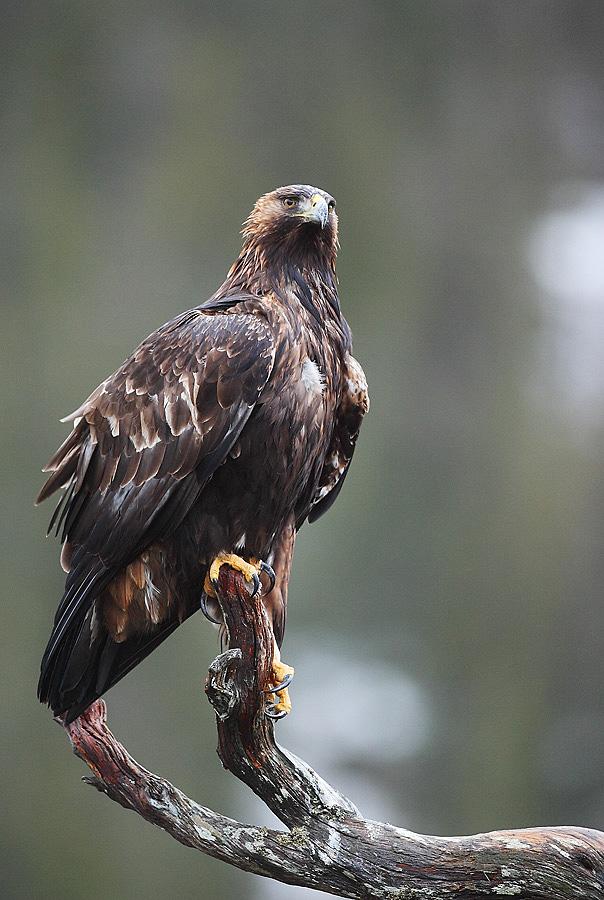
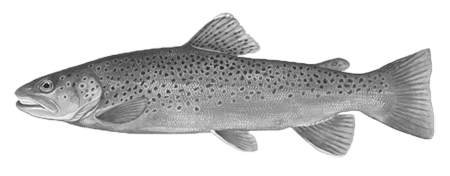
According to this article, the Norwegian parliament, under pressure from the lobby of sheep farmers and reindeer herders, is about to authorize hunting the golden eagle—a protected species everywhere in Europe and the rest of the world.
Unfortunately, the eagle isn’t the first victim of the sheep farmers’ lobby in this country. Yet Norway is often cited as an example of sound ecological and environmental policy! Over the last few years, the Norwegian parliament has re-introduced the permission to slaughter many protected species such as the wolf, the lynx, the bear and the wolverine. And the list is growing longer without alarming anyone, or almost anyone.
Moreover, Norway isn’t the only country engaged in this environmental regression: France is following close behind, with its recent authorization to slaughter wolves for the same reasons.
Biodiversity has already been seriously threatened by other economic sectors and human expansion in general; this policy endangers it still more.
As citizens, hikers and lovers of the wilderness (what's left of it), we think it’s time to use our most powerful weapon: buying power!
It’s time to make outmoded politicians and the lobbies manipulating them realize that we don’t want to buy the products of sheep-farming or reindeer-herding when it is carried out to the detriment of wild animals and biodiversity.
Read the complete article here (in English)
Conversation with a mountain hiker
It was while we were climbing to the top of Narvtinden that we met Håkon and his girlfriend Kristin. At the pass, before the final steep section we saw two hikers with a small black dog that was briskly climbing the 40°slope. Despite the short distance that separated us we were only able to catch up with them at the top when we immediately began chatting.
Håkon, a 33 year old Norwegian, agreed to answer our questions and to meet us, outside on a small mountain overlooking the plateau of Leknes a stone’s throw from the Gravdal hospital where he works as a radiologist. This is where he comes after work to run or just get a breath of fresh air.
 Rando-Lofoten: Do you practice any sports other than hiking?
Håkon: I use to be a very keen cross-country skier (langrennsløper), but that’s quite a while ago. When I was younger I was eager to take up the sport seriously but I had to stop when I was 17 due to various injuries. First of all I injured my knee and they didn’t know what was wrong at the time. Then, when I started again, I injured my elbow.
Rando-Lofoten: Did you practice cross-country skiing at a high level?
Håkon: Well, when I was 16 I won the north Norway championship in my category (nord norges mesterskap). But I haven’t done much since. I keep training though. I like to train and keep in good shape. I jog in summer and in winter I do endurance training and cross-country skiing, both traditional and skating. In winter I also like to go on long ski hikes pulling a pulk (sledge) from chalet to chalet. I am also slightly unusual in that I enjoy sleeping in a tent in winter. Most people find it too cold but I like it and I am lucky in that I don’t really feel the cold.
I am very lucky with my working hours at the hospital where we work shifts. I often have five or six days off at a time and then I go to the mainland where I have a lot of friends whom I call to see whether they are free to come with me.
Rando-Lofoten: When we met the first time you mentioned a sort of challenge, which is to climb all the peaks on the islands? Could you tell us a little more?
Håkon: It all began in my hometown in the Lyngen Alps where I was already used to walking the peaks. It was part of my growing up. I was two years old when I first went to the mountains and I didn’t want to stay in the baby carrier. I was determined to walk (laughter). So it goes back quite a way. In general I have always been attracted by the mountains, and in different ways. First there is the physical aspect, I like to stay in shape, but it’s also, and above all, nature itself. When I first arrived in the Lofoten Islands five years ago I began walking over the various peaks and I heard of someone who had climbed all the peaks over 100 m altitude in Vestvågøya, the central island of the Lofotens. I thought climbing 100 m peaks was a bit too low. It wasn’t that the challenge had to become an athletic exploit at all costs, but by setting the limit at 100 m altitude you have to climb all the small hills and therefore spend a long time with your head in the map. I thought it was a bit stupid. I had already climbed quite a few peaks in the Lofoten Islands and I thought why not climb the others, so that I could say I’ve done them all. This desire to climb all the peaks comes from the fact that, in general, I like to go to new places. It’s exciting because you never know beforehand what the climb is actually going to be like. What’s it going to be like actually walking there? What you see on the map is one thing, but will I manage to get to the top? Some of them are such steep slopes that when I start out I don’t know whether I will manage to get to the top. And, of course, what’s the view like from up there? Even though you have climbed the neighbouring peak, you don’t know what it will be like on this one.
What motivates me is to find out what it’s like when you are actually there, out of curiosity and of course for the experiences and sensations you have in nature, with animals for example. But it’s true that you can have contact with nature even if you always climb the same peak. You get an extra buzz if you always go to new places, it makes the whole experience a bit more mysterious (laughter)… and it gives you a goal.
Rando-Lofoten: How many peaks have you climbed since you began 5 years ago?
Håkon: On the island of Vestvågøya I have climbed around 140 peaks over 300 m altitude, but it a bit depends on the criteria you use to count them… I haven’t followed strict rules as such. On the whole I have climbed all the peaks that have a name. Then I started on the island of Flakstad where I climbed around 80. I have therefore climbed up to all the peaks on the island. Then I started in Moskenesøya. In the north of the island the only one I haven’t climbed is Ulvstinden (Wolf’s Peak) and the summits of Lillejordtinden. I haven’t been much to the south of the island, but I’m working on it.
 Rando-Lofoten: Now that you have climbed all the peaks in Flakstadøya and Vestvågøya as well as those in Moskenesøya, you have almost achieved your goal. What are you going to do afterwards, have you already got an idea for a new challenge?
Håkon: I’ve still got the island of Vågan in the Lofotens to do, but I haven’t yet made up my mind. It’s also because I prefer landscapes with low vegetation, open landscapes. It’s what I find most appealing. Whether for hiking or setting up my tent, I prefer this type of vegetation (he points to the thick cushion-like layer we are sitting on, made up of moss, lichen and small shrubs). In Vågan there are a lot of trees and forest, you almost need to have a saw with you to cut your way through to certain peaks. But I’m not saying I won’t do it.
Rando-Lofoten: And after the Lofoten Islands are you going to continue climbing peaks elsewhere?
Håkon: No, well I don’t really know. I’ll take it as it comes. Even though it’s not become an actual obsession, I am very interested nevertheless. (laughter)
Rando-Lofoten: Did you fit in easily in the Lofoten Islands?
Håkon: I found it very easy. North Norway (Nord Norge) has the reputation of being very welcoming. There is a big difference between the north and south of the country. For example in north Norway, it is possible to pick up a hitchhiker and bring him home, ask him to stay for dinner and suggest he stay a night or two. Such things are not unheard of. Many Norwegians from the south are surprised at the welcome and how easy it is to be asked to stay. In that respect I don’t see any difference between the Lofoten Islands and the place where I was born (Lyngen) which are both in the same region. There are small local differences in Nordland of course. In Bodø, for example, people are more reserved whereas in Tromsø, which is a student town, you can easily speak to anyone in the street.
Rando-Lofoten: To return to nature, is there something special here in the Lofoten Islands compared to where you come from? Many people, both abroad and in Norway, talk and dream of this place.
Håkon: I remember the first time I came to the Lofoten Islands. I took the car and crossed the fjord by ferry because I was living in Bodø at the time. I remember when the boat opened its doors and I saw the Lofoten Islands. You get to the wharf in Moskenes and it seems like the mountains are literally falling on it. What’s strange is that even though the mountains are lower than elsewhere, they are extremely close. There is little vegetation and everything seems very close.
The Lofoten Islands have often been compared to a miniature version of the Lyngen Alps. And for me who grew up in Lyngen, I understand because whether here or in Lyngen, you always have the fjord and the ever-present sea. The main difference is the mountains which are much higher in Lyngen. The highest peak where I come from is 1833 m, and on average they are around 1200 or 1300 m. In the Lofoten Islands the average must be around 600-700 m.
What I love in the Lofoten Islands are all these small places, all these little groups of houses, like in Nusfjord towards Sund, all these little hamlets spread over the archipelago. It’s a little self-contained world, a land of tales in which you don’t feel enclosed because the landscapes are very open.
Rando-Lofoten: Do the Norwegians, particularly the people from the Lofoten Islands, have a special relationship with nature, and if so, why?
Håkon: To answer that we need to go back in time a little, when there were no shops or anything. The people here had to live very close to nature because it’s how they survived, through fishing. It was the main source of food in the Lofoten Islands and you can still see the traces today with the houses on stilts (rorbu). The houses were built on the premise that nothing was more important than fishing. Being close to nature was a vital necessity. There are a lot of stories on the subject according to which the fishermen knew every nook and cranny of the shore like the back of their hand and they only had to spot a small piece of land through the mist to know where they were. They had to be familiar with nature in order to survive and learn a lot of tricks. There is no doubt that there are differences between the people from the Lofoten Islands, who are closer to nature, and people in the big cities, particularly in the past when the town dwellers got their food in other ways.
But nowadays in the Lofoten Islands I am just as likely to meet a tourist as a local when I walk in the mountains. Not many of the locals hike here. In the south of Norway, where there are far more people, there are very popular treks and hikes (Hardangervida, Jotunheimen, etc.) where you meet a lot of people whereas in the north of Norway, whether in the Lyngen Alps or the Lofoten Islands, you are more likely to come across tourists than locals.
Rando-Lofoten: Isn’t the fact that not many locals here go hiking mainly because their lives were entirely focused on fishing and therefore the sea rather than inland?
Håkon: It’s true that there’s not much to hunt here, no large mammals for example. Remains of birds have been found that the people used to hunt, but that’s about all.
If I can tell you a story, it reminds me of when I went hiking close to where I lived on the mainland and I met an old man. It was winter and he said I could park on his land. I then went up into the valley, I went on a long hike, on my own, and when I came back he asked me what the purpose of my walk was… and then told me that he used to go often to the mountains when he was a child but to hunt partridge. He therefore had a reason for going. He couldn’t understand why I went into the countryside on my own for no purpose, as far as he could see. And another time when I was out in the kayak on my own a man came over on a boat to see me and we began talking. He quickly explained that a little further on towards the end of the fjord there was a chalet with people, and that I should not hesitate to go in for a chat. I really had the impression he thought I was lonely. He couldn’t imagine that I could be there on my own and enjoy myself.
Rando-Lofoten: Do the young Norwegians go hiking?
Håkon: There are high hopes for open-air activities. The Norwegian tourist offices have really promoted these activities. There have also been adverts on the TV. The matter has also been discussed at length in the public health debates. Being active, going hiking has become sort of trendy, and it’s getting more so. It has to be said that things have changed a lot in Norway. If we look at my father’s generation, or rather that of my grandfather, they were so worn out by work that at the weekend all they wanted to do was rest. But we now have time to go for a walk and I am aware that in Norway we no longer work as hard or for as long as in other countries. It doesn’t mean that everyone will go for a walk but research has shown that more educated people are generally more attentive to their physical condition and more likely to take exercise.
 Rando-Lofoten: We’re actually not that far from Lapland, do the Sami people have a different relationships with nature compared to the other Norwegians?
Håkon: I know a few stories about the Sami people. They know the Vida (tundra plateau) really well. It all looks the same to us, one mound is like another. But they are able to find their way without GPS or maps. They have the map here, in their mind. It’s incredible, there may be no visibility but they will eventually find their way. I have a relative who works in Svalbard (Spitzbergen) in charge of rescue and she told me a story on this subject. A group got lost in the countryside and split up, such that a Sami found himself alone. The other part of the group eventually reached Longerbyen, the capital of Spitzbergen, but the Sami was missing. Someone said, jokingly “Don’t worry he’s a Sami, he’ll find his way”. And he did indeed reappear, he had no GPS or any means of determining where he was, no visibility and a strong wind was blowing. When he arrived he was asked how he managed it. He replied jokingly “I sniffed out the route”. They have something we don’t.
My father, who was at school near Alta (a town in Norwegian Lapland), told me he had planned to go fishing with Sami friends. It had been raining heavily for several days. They were going to light a fire and as everything was soaking wet, my father thought it would never take. But, surprising though it may seem, the fire was lit in only a few seconds. And apparently everything had dried out. They knew how to go about it.
Rando-Lofoten: Do many Sami live in the Lofoten Islands?
Håkon: There are some. I have Sami blood. I tell people for a joke that I have the very old genes of the original people (Laughter). In Lyngen the following three branches interbred: Nordmen (Norwegians), Kvens (an ethnic minority in Norway, originally from northern Finland and Sweden who migrated to north Norway in the 18th and 19th centuries) and the Sami. The people mixed. For myself we have to go a bit further up the family tree, but I have, for example, Sami cousins who breed reindeer in Finnmark. The Sami have been oppressed for a long time in Norway. But that’s changed nowadays. In my hometown in Lyngen the signs are in three languages: Sami, Kven and Norwegian, they are all official languages.
Large crows fly overhead, they seem to be having fun with the wind that sweeps across the top of the peak on which we are standing. They are doing synchronised flying in pairs.
Rando-Lofoten: It’s perhaps not very poetic but those birds fly like fighter planes!
Håkon: Yes, they train while playing. They are one of the few birds that can fly upside down.
I have had incredible encounters with birds, particularly eagles. Once I must have been near a nesting zone. A dozen eagles began flying round overhead and just as I looked upwards to watch them, I saw one of them open its talons and a small lump of earth fell at my feet. It was a warning, even though I have never heard of any real eagle attacks. I had already had a similar experience when I found myself very close to an eagle’s nest. The parent pretended to dive-bomb me. It stopped nevertheless twenty metres or so above me, it was only pretending to attack, but it’s frightening nevertheless, particularly when it comes at you with its talons open. Another time high up in the mountains, I was looking for another way to get down and I arrived at the edge of a steep cliff. I leant slightly over the edge to see, and approximately half a metre below me there was an eagle sitting on its nest (white-tailed eagles can have a wingspan of up to 2 m 70 and their body is the size of a dog). It turned around and looked at me. I watched it for some time, it didn’t move. I will always remember it. It was only on the way down that I realised I could have taken a photo, but perhaps it wouldn’t have been very good and it wouldn’t have been as good as the image I have kept in my mind.
Interview translated from Norwegian by David and Magdalena, the 5th of septembre 2013

The people of the Lofoten Islands say there has not been such a mild winter for 100 years!
As far as we are concerned we prefer to wait for the statistics to be published by the authoritative “National Meteorological Institute” before we express an opinion, but the following facts cannot, however, be ignored:
- Temperatures of +5 to +6°C in February
- Still no snow, or very little on the peaks
- A spring-like feel to the air (buds, catkins, birds building their nests, etc.)
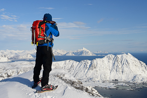
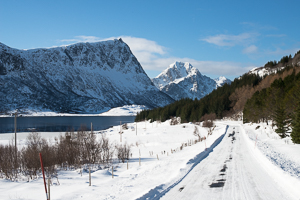
We have put our snow shoes away and taken out our hiking shoes to explore the Lofoten Islands in temperatures and countryside similar to those of the month of May! Using small crampons to help us climb the mountain tops, we are making the most of the unusually mild temperatures to do in winter what we usually do throughout the summer: explore, draw up and publish new hiking routes on Rando-Lofoten.
Here are a few photos to give you an idea of winter in the Lofoten Islands and some of our new hikes…
Watching opportunities
Excellent
| Good | Medium | None* |
| March | February | January | May |
| October | Beginig of April | November | June |
| | September | December | July |
| | | | August |
*Impossible to watch at Northern light due to constant daylight
 The National Oceanic and Atmospheric Administration (NOAA) has implemented a real-time northern light prediction map for each hemisphere.
This map gives a forecast, for the next 30 to 40 minutes, showing the size of the aurora and the places in the world where it can be observed. The probability as well as the intensity of the light is represented by a gradient of colors (going from green to red).
Note: In order to observe the northern lights, it is essential that the sky is cloudfree. Therefore it is important to cross the data below with the one of the local weather forcast.
Here you'll find the last update of the map.

For more information you can visit the site directly from NOAA at the following address: http://www.swpc.noaa.gov/products/30-minute-aurora-forecast
3 days Aurora forcast
What’s the Kp-index?
The Kp-index is the global geomagnetic storm index. It ranges from 0 to 9, where a value of 0 means that there is very little geomagnetic activity and a value of 9 means extreme geomagnetic storming. Depending on your geomagnetic latitude (were you are), and on the Kp value, you will know if there is any chance for you to see an aurora.
How does the Kp-index work?
The table below shows you until which latitude you will be able to observe the Auroral Oval, depending on the Kp strength.
| Kp | Geomagnetic latitude | Auroral activity |
| Kp 0 | 66,5° or higher | Very low |
| Kp 1 | 64,5° | Low |
| Kp 2 | 62,5° | Low |
| Kp 3 | 60,4° | Unsettled |
| Kp 4 | 58,3° | Active |
| Kp 5 | 56,3° | Minor Storm |
| Kp 6 | 54,2° | Moderate storm |
| Kp 7 | 52,2° | Strong storm |
| Kp 8 | 50,1° | Severe storm |
| Kp 9 | 48,1° or less | Extreme storm |
Example: With a Kp 0; you can observe an aurora in Tromso in Norway, with a Kp 5; you can see the aurora all the way to Edinburg in Scotland, and with a Kp9 (the maximum that is possible), you can view an aurora all the way to Marseille in France.
Prevision for the next 3 days
Note: This list, gives some interesting/practical links (in alphabetical order) in relation with the observation and the understanding of the aurora phenomena. This list is not exhaustive, and you are very welcome to suggest new links through our contact form.
www.norway-lights.com
This website gives a 3 days-prevision in any town of Norway. Direct link to the Lofoten.
www.spaceweatherlive.com
You will find updated solar activity previsions, as well as auroral activity previsions, with clear explanations to understand the data. Multilingual website.
www.gi.alaska.edu/AuroraForecast/Europ/
The official website of Alaska Fairbanks University, gives a 21 days forecast for auroral activity in both hemispheres, as well as some practical information.
NOAA - National Oceanic and Atmospheric Administration
The prestigious American agency provides most of “space forecasts” data used by the worldwide scientific community.
Smartphone apps’:
Northern Eye : is a free app' that allows you to follow the aurora forecasts for the 3 next days (with information on the Kp, Bz, the solar windspeed, etc).
I am Martin and I have spend over 2 months in Lofoten in 2017 to capture photos of northern lights - one of the best shows you can see on the sky.
You can see the results here on my website: www.martin.kulhavy.info

Tips and tricks:
1) equipment
Astrophotography is demanding high performance from your camera and lens. You will get best results with interchangeable lens cameras (mirrorless or single-lens reflex camera). Use wide and bright (low aperture number) lenses. There are several lenses specialized for astrophotography which could be also useful for "normal" landscape photography. I use Samyang 14mm f/2.4. My other recommendation would be Samyang 14mm f/2.8, IRIX 15mm f/2.4 or an expensive Sigma 14mm f/1.8. Spare battery, tripod and cable release is also necessary.
2) Check the weather and space forecast
Clear sky is essential for your success, so save your energy in cloudy days to be ready for clear nights. Check the short term forecast on yr.no. Detailed view will give you indication for the cloud level. Spaceweather.com or Aurora mobile app helps with forecasting of solar and aurora activity. Lofoten is north enough for observing lights even at low KP indexes (2 or 3). Higher KP index is obviously better, but it doesn't guarantee anything.
3) Location
Find your location in advance. Look for places with good view to the north. There is no general rule for this point. You can find one many hikes on this website (www.hiking-lofoten.net). I recommend to stick with your plan in the evening, You don't want to spent the precious time while driving between locations. Be patient, sometimes lights appear for only a brief moment after few hours of waiting. Keep walking around your tripod in winter to stay warm.
4) Shooting tricks
Shoot on Manual settings. My general settings are ISO 3200, f/2.4, t=3s and then I adjust time shutter speed accordingly to the situation. If the lights are weak, then I go to t=8s, stronger light can reduce the time to 1s. Please note that you must recalculate the shutter speed if your minimal aperture number is higher. Example: if your minimal aperture number is f/3.5, then your times should be between 2 and 15 seconds. You can reduce then to 1-8 seconds by increasing ISO to 6400, but your images will be noisier. The brightness changes rapidly and it is important to change your shutter speed immediately to get rightly exposed photos.
Shoot panoramas. Even 14mm wide lens is often not wide enough for aurora oval. All my photos are full 360 panoramas. There are many websites describing details of 360 photography. Fell free to contact me if you have any questions.
Martin Kulhavy

Northern lights in the Lofoten islands
Here you'll find some useful information for when you are planning a winter trip to the Lofoten Islands.
To know what the actual snow coverage will be
1) Take a look at the different webcams (on Hiking-Lofoten's home page, at the bottom of the left column)
2) Look at the weather forecast on yr.no (10 days weather forecast)
3) Check the daily updated snow-coverage table on yr.no (for the Lofoten Islands check the line : Norland/Flakstad/Skjelfjord, 13moh - at the lower part of the list)
To know what the actual avalanche risk
There are two different tools giving avalanche forecasts online:
1) The avalanche risk scale (yr.no)
2) The Lofoten and Vestralen avalanche risk scale forecast (varsom.no)
Notice : These different tools that will help you to keep safe, won't make you invincible! You must stay extremely cautious regarding avalanches: due to the extreme relief and the frequent changes in temperatures during winter, they can happen nearly everywhere and at anytime in the Lofoten Islands. Snow avalanches are often accompanied by rockslides.
Emergency numbers
113 Medical care
112 Police
The following people and organisations have given freely of their time, helping with the content and technical aspects of developing this site. The entire Rando-Lofoten team and all the site users would like to thank them warmly for their help.
Halfdan Holm
In 2014, shortly after we created this website, we were contacted by someone with an intriguing pseudo: "Hr. Frosk" (Mr. Frog in English). This person offered us routes, pictures and descriptions of the hikes he had made during the last 7 summers spent in the Lofoten Islands. We integrated his hikes and went to test them in situ, to discover they were excellent. It was only some months later that we learned that Hr.Frosk, whose real name is Halfdan Holm, was a 15-year-old boy, a Norwegian high school student, already incredibly passionate about hiking and nature!
Since, we've had the chance to do some of the hikes described on the website in his company. Haldan is currently attending the "Klatring og Topptur" class at Lofoten Folkehøgskole (climbing and mountain hiking at the Folk High school of Lofoten), and continues to feed hiking-lofoten regularly, with new original tracks...
Thank you Halfdan for sharing all this valuable knowledge, we hope that your example will inspire other hikers :)
Christian, who helped us when we began creating our site with Joomla. Many thanks for the countless hours spent spotting and correcting our mistakes. This site would probably not exist without his help.
Max, for his great Forum "Chronoforum" and the many changes he has made to it, always with the same patience, professionalism and kindness.
For further information on Max’s work: www.chronoengine.com
Frank, for his essential GPXTrackmap plugin which enables us to show you our GPS traks (satellite navigation) on the best map backgrounds currently available for Norway! Thanks for the time he has spent integrating the Norgeskart.no maps into his Plugin.
For further information on Frank’s work : http://software.frankingermann.de/
Kartverket.no (Norwegian Mapping Authority), for letting us use their vector map backgrounds free of charge, and for giving us the integration codes for Joomla.
For further information on Kartverket: http://www.kartverket.no/

Allemannsretten
This law defines the rights of each individual over the property (land) of others. Most of these rights, which have been acquired over time, are laid down in the 1957 “Friluftsloven” Act of Parliament which governs outdoor pursuits in Norway..
Most of this Act focuses on the right to access other people’s property, which is divided into “innmark” and “utmark”.
Innmark (grazing or farmland) is the zone in which owners may reasonably demand peace and quiet. For example, the plot of land on which their house or chalet is built, or land they farm comes under the definition of innmark. In this zone “Allemannsretten” has limited application. For example, it is permitted to access innmark in winter (from 14/10 to 30/04 when the ground is frozen) except for enclosed plots of land and within the immediate vicinity of houses. During the summer season you must stay on the marked tracks or paths open to general access in order to hike in innmark. Camping and bivouacking in an innmark zone require the
owner’s consent.
In utmark, which the law defines as “unfarmed land not considered innmark” free access of people whether on foot, skis, horseback or bike, is authorised provided you take due care over the natural environment and the place you are crossing. It is prohibited to cut down trees and shrubs, to disturb the animals and birds, all animal life is protected. Dog owners are fully responsible for their dogs and any damage they may cause. Dogs may only be let off the leash provided their owners can see them and control them at all times. In order not to disturb the wild animals and cattle, dogs must be kept on a leash from 1/04 to 20/08. The other rights governed by the Friluftsloven act cover bathing, which you may do at reasonable distance from houses, and camping which is restricted to two nights in the same place at a reasonable distance from houses (minimum 150m). If you want to camp less than 150m from a house or for longer than two days you must ask the owner’s or farmer’s permission.
It is also permitted to pick berries, mushrooms, walnuts and hazelnuts, and also flowers except in protected areas and zones (e.g. natural parks). Lastly, it is prohibited to make fires in the forest or heathland from 15/04 to 15/09 except for mountainous zones without vegetation.
Text translated from Norwegian by Rando-Lofoten
NB the information below is given as an indication only, the laws, regulations and bans on sea and freshwater fishing may be modified. There are therefore many local regulations that govern different types of fishing, particularly freshwater, where fishing permits are often necessary, including rivers and salmonid (salmon, trout, whitefish) fishing. If you have any doubts about the regulations, check with the local tourist office.
General information on sea fishing
Who can fish and with what tackle?
Only Norwegian nationals or foreign residents with a fixed address in Norway are authorised to used “fixed” fishing tackle in Norwegian territorial waters: nets, longlines, traps (baskets, etc.) and bottom line fishing.
Non-resident foreigners may fish with “hand-held” tackle such as fishing rods or hand-held lines (for fishing from the stern of a moving boat) but are not allowed to sell their catch (summary of fishing law 1983-06-03 No. 40).
Quotas for recreational fishing (maximum authorised quantities)
It is prohibited to carry over 15 kg of fish per person across Norwegian borders. This applies to foreigners and Norwegians alike.
Minimum authorised sizes
Extract of the law on sea fishing, translated from Norwegian (law 2004-12-22 - 1878 chapter 9). The full legislative text may be read (in Norwegian) by clicking here. Rando-Lofoten have added explanations where necessary (in blue).
Chapter IX. Minimum sizes and steps to limit the catching of fish below the minimum size
paragraph 43. Minimum sizes
It is prohibited to catch fish under the following sizes:
|
| 1. | Halibut | 80 cm |
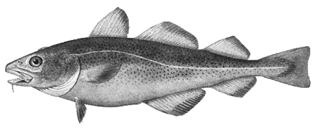
| 2. | Cod
a) North of 62° N
b) South of 62° N |
44 cm
40 cm |
| 3. | Haddock
a) North of 62° N
b) South of 62° N |
40 cm
31 cm |
| 4. | Hake | 30 cm |
| 5. | Plaice
a) In the zone described in paragraph No. 3 1, 2 and 3 (except for the Skagerrak)
b) In the Skagerrak described in paragraph 3 No. 4 (the Skagerrak) |
29 cm
27 cm |
| 6. | Witch flounder (RL : Glyptocephalus cynoglossus) | 28 cm |
| 7. | Sole | 23 cm |
| 8. | Lemon-sole | 25 cm |
| 9. | Common sole | 24 cm |
| 10. | Turbot | 30 cm |
| 11. | Brill | 30 cm |
| 12. | Megrim | 25 cm |
| 13. | Whiting | 32 cm |
| 14. | Flounder | 20 cm |
| 15. |
Eel
a) Before sexual maturity
b) After sexual maturity |
40 cm
37 cm |
| 16. |
Pollock
a) North of 62° N
b) South of 62° N |
45 cm
40 cm |
| | c) Minimum size for fishing with a “not” type net (RL: the “not” in Norwegian is a net used to catch fish like in a creel (basket); fish do not get caught in the mesh as they do in standard nets). NB non-resident foreigners are prohibited from using fishing nets. We have not therefore considered it necessary to translate the relative section of the Act of Parliament.
| |
| 17. | Dogfish | 70 cm |
| 18. | Greenland halibut | 45 cm |
| 19. | Monkfish (RL: caught with a net, so non-resident foreigners are not allowed to catch them) | 60 cm |
| 20. |
Golden redfish
a) Beyond 12 nautical miles of the coast
b) Within 12 miles of the coast |
30 cm
32 cm |
| 21. | Mackerel | 30 cm |
| 22. | Herring fished in the zone described in paragraph 3 No. 4 (the Skagerrak), except for fjord herring within 2 nautical miles of the coast. | 18 cm |
| 23. | Atlantic herring | 20 cm |
| 24. | Norwegian herring spawning in the spring | 25 cm |
| 25. | Herring in Trondheim Fjord | 23 cm |
| 26. |
Capelin
a) North of 62° N
b) In the fishing zone near Jan Mayen (RL: Norwegian island) |
11 cm
12 cm |
| 27. | Shrimp | 6 cm |
| 28. | Dublin Bay prawn | 13 cm |
| 29. | Crab | 13 cm |
| 30. | Crab along the coast of Rogaland towards Sweden | 11 cm |
| 31. | Iceland scallop in Nordland, Troms and places in Finnmark | 6,5 cm |
| 32. | Lobster | 25 cm |
| 33. | King crab in East-Finnmark, controlled by quotas | 13 cm |
| 34. | Scallops | 10 cm |
| 35. | Wrasse | 11 cm |
| 36. | Sand eels | 10 cm |
| 37. | Sprat within 4 nautical miles of the coast | 9 cm |
paragraph 44. How to measure fish
- Fish are measured from the tip of the upper jaw to the end of the shortest caudal ray. (RL: you measure the length to the fork in the tail)

- Dogfish are measured from the tip of the upper jaw to the to the end of the upper tail fin.
- Lobster and Dublin Bay prawns are measured from the rostrum to the end of the tail.
- Shrimp are measured from the front of the eye to the back of the tail.
- Crabs are measured along the widest section of the shell.
- Iceland scallops are measured along the length (from the hinge to the other end).
- Scallops are measured along the longest section of the shell.
- King crabs are measured from lowest part of the eye socket to the hollow in the middle of the shell.
NB the information below is given for information only, the laws, regulations and bans on sea and freshwater fishing may be modified. There are therefore many local regulations that govern different types of fishing, particularly freshwater, where fishing permits are often necessary including rivers and salmonid (salmon, trout, whitefish) fishing. If you have any doubts about regulations, check with the local tourist office.
General information on freshwater fishing
Freshwater fishing is governed by the Act of Parliament dated 15 May 1992 in Norway and applies to salmonids and all other freshwater fish. Some of the following information comes from the official Norwegian site http://www.miljodirektoratet.no which summarises most of what you need to know about freshwater fishing.
Who is entitled to fish in freshwater?
In freshwater, owners are entitled to fish as far as the boundaries of their property. Anyone can fish outside private property.
Fishing rights can be granted to private individuals or organisations or made available through fishing permits.
On land belonging to the State and in the region of Finnmark the State owns the fishing rights and grants them to the general public. Anyone over the age of 16 who wants to fish salmonids or freshwater fish must pay a fishing fee to the Statens Fiskefond (State fishing foundation).
Provisions for the general protection of salmonids
The 1992 Act of Parliament makes a clear distinction between fishing anadromous (fish that ascend rivers from the sea to breed) salmonids (salmon, sea trout and arctic char) and other freshwater fish (including eels and crayfish). The Act of Parliament prohibits the fishing of freshwater fish (which is less restrictive than that of salmonids) in rivers where there are anadromous salmonids, unless the law stipulates otherwise (waiver). In rivers, it is only permitted to fish for anadromous salmonids with a rod or line and only in rivers or sections of river clearly defined by the local authorities (regulation dated 20 June 2003).
What you need to know about salmonid fishing
- Only fishing with a rod or line (handheld) is authorised. Only the following baits are authorised: worms, flies, trolling spoons, wobblers and spinners
- You need to find out the times of year when fishing is authorised and whether specific rules apply to each river.
- The fishing season begins on most rivers on 15 June (sometimes later) because the salmon population is much smaller. In rivers where there are more salmon the fishing season may, however, begin earlier.
- You need to buy a fishing permit or be given fishing authorisation by the owner.
- There are regulatory sizes for hooks (single hook: 15mm gape between the hook shank and point, for triple hooks: 13mm max.)
- A fishing fee must be paid when fishing for salmon, sea trout and arctic char
Provisions for the general protection of “other” freshwater fish
Even though there are no general regulations for freshwater fish, the local authorities may take decisions that apply to certain places, rivers or other areas (e.g. a ban on fishing for up to 5 years, determine the authorised fishing tackle, authorise the closure of certain rivers to eel fishing, etc.).
What you need to know about freshwater fishing (other than salmonids)
- It is prohibited to use poison, explosives, electric current or firearms, or artificial light (except for crayfish). Other than these bans there are no general rules on fishing tackle or the fishing season, except for crayfish and freshwater mussels. On the other hand there are often local rules. You should check them out before you start fishing.
- You need to buy a fishing permit or be given fishing authorisation by the owner.
How it all started...
The Hiking-Lofoten site was originally created by two mountain guides who had worked in the Lofoten Islands for years. The site was then considerably enriched by both professional hikers and ordinary travellers with a passion for the islands.
The idea came from the fact that even though the Lofoten Islands are an endless source of fantastic hikes, the maps currently available in the shops are often limited to a base map which, while there is nothing essentially wrong with it, has had a lot of tracks superimposed that are not only lacking but often misleading.
Rando Lofoten set out to fill in the gaps left by the overwhelming lack of information.
All the participants in the site are volunteers and work on developing the Hiking-Lofoten site in their spare time, their only motivation being to share their knowledge and fascination for the islands.
Why this project?
The aim of R-L is to eventually provide everyone with accurate, complete maps of all the hiking trails in the archipelago. All the information available on the site (GPS tracks, type of landscape for hiking, descriptions, general information) is checked and frequently updated. It is a huge task, despite the archipelago being relatively small (160km long, 15km wide on average)!
We already have over 80 hikes available on the site after being in existence for four years now. We hope to achieve our objective by late 2017…
The people behind Hiking-Lofoten
David 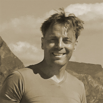 Souyris: A qualified French Mountain Guide who has worked in the Lofoten Islands since 2002 for French and foreign tour operators specialising in hiking.

Magdalena Brede: Norwegian Mountain Guide. Has accompanied groups to the Lofoten Islands and throughout Norway since 2006 on behalf of French tour operators.
Terms of use
This site is published by M&D Smart Factory, a proprietorship, listed on the Commercial Register in Middelburg (kvk) under n°80131891 and registered offices at Nieuwstraat 29, 4331JK, Middelburg (NL). Intra-community VAT No. NL003396677B15.
M&D Smart Factory is listed as "Organising other sport events and publishing books" under n° 000029231833. The Publication Director is Magdalena Brede Souyris in her owner's capacity.
Any representation whether total or partial of this site or content (general structure, texts, sound, logos, images whether animated or otherwise), by any method whatsoever, without M&D Smart factory’s express prior approval is prohibited and constitutes infringement sanctioned by the Intellectual Property Code.
You are entitled to access, modify, rectify and remove information concerning you (Art. 17 of the GDPR / Algemene Verordening Gegevensbescherming). This information is intended for M&D Smart Factory but may be given to third parties.
To exercise your rights or if you do not want your information to be given to third parties, write to M&D Smart Factory - Service Relations Clientèle,Nieuwstraat 29, 4331JK, Middelburg (NL).
All the data presented here is provided by Google Analytics.
Hiking-lofoten.net creation date: 1 May 2013
Statistics covering the period from 01/05/2013 to 12/12/2014
Analysis of hits
With over 43,000 hits and 480,000 pages viewed during the first year of activity (01/01/14 – 31/12/14) Hiking-lofoten.net has proved a great success, attracting a very large number of visitors to a subject as specific and unusual as hiking in the Lofoten Islands.
A more in-depth analysis shows that the users appear to be satisfied with the content. It has become apparent that the “bounce rate” is extremely low at 2.75% and that the “return rate” to the site is extremely high at 43%! The average session time (over 7 minutes) and the average number of pages viewed at each visit (11.2) show the extent to which visitors are interested by the information on the site.
These very positive results encourage us to continue developing content that is increasingly thorough and FREE on hiking in the Lofoten Islands.
| Hits 2013/2014 Sessions: 8575 / 43.470
Users: 5154 / 24.808
Pages viewed: 54.075 / 483.172
Pages viewed at each visit: 6,31 / 11,12
Average duration of sessions: 00 :07 :03 / 00 :06 :50
Bounce rate: 40% / 2,75%
New sessions: 56,79% / 60,10% See PDF Google Analytics | | Changes in hits 2013/2014 Sessions: 406,94%
Users: 381,33%
Pages viewed: 793,52%
Pages viewed at each visit: 76,26%
Average duration of sessions: 3,02%
Bounce rate: -93,12%
New sessions: -5,52% See PDF Google Analytics |
Demographic data
(2014 only) Sexe :
Male : 51,62%
Female : 48,38% See PDF Google Analytics Age :
25-34 : 38,64%
35-44 : 16,14%
55-64 : 15,33%
45-54 : 13,40%
18-24 : 8,92%
65+ : 7,57% See PDF Google Analytics | | Geographic origin
(2014 only)  France : 51,54% France : 51,54%
 Norway : 13,60% Norway : 13,60%
 Switzerland : 4,74% Switzerland : 4,74%
 Belgium : 4,42% Belgium : 4,42%
 Netherlands : 3,53% Netherlands : 3,53%
 Germany : 3,29% Germany : 3,29%
 United States : 2,86% United States : 2,86%
 United Kingdom : 2,47% United Kingdom : 2,47%
 Italy : 1,67% Italy : 1,67%
 Sweden : 1,42% Sweden : 1,42%
Other: 10,46%
See PDF Google Analytics |
Definitions of visit criteria - (Source: Google Analytics)
Sessions: the total number of sessions over the period. A session is the period during which users are active on a website, its applications, etc. All the user data (screen viewing, events, e-commerce, etc.) is associated with a session.
Users: the number of users who have opened at least one session over the selected period. This statistic includes both new and unknown users.
Pages viewed: the total number of pages viewed. Repeated visits by an internet user are included.
Pages/session: (average number of pages) the average number of pages viewed during a session. Repeated visits by an internet user are included.
Average length of sessions: the average length of a session.
Bounce rate: the bounce rate is the percentage of visits to a single page, i.e. visits during which internet users leave your site as soon as they reach the home page, without interacting with the page.
% new sessions: an estimate of the percentage of initial visits.
The start of 2019 marks the sixth year of Hiking-lofoten's existence, and we thought it was time to update the “consultation statistics” (yep, they haven’t been updated since 2015 ;-)).
The analysis of this anonymous data provided by Google Analytics gives us - in addition to the satisfaction of looking at these nice figures - a better understanding of what visitors come to look for. In short it allows us to improve the content of the website.
Of course, we prefer direct contact with users telling us what they would like to see on the website or what isn't so useful. So, let's say it again: do not hesitate to contact us by email to share your suggestions, so we can make new improvements.
In any case, we believe that it is normal and interesting for users to be informed about Hiking-Lofoten's functioning and its evolution.
Users
Visits / sessions data
YEAR | 2014 | 2015 | 2016 | 2017 | 2018 |
Users1 | 24.808 | 57.851 | 96.972 | 135.734 | 161.424 |
User progress compared to the previous year |
| +133,19% | +67,62% | +38,62% | +18,93% |
New users2 | 24.686 | 57.353 | 96.041 | 133.342 | 159.059 |
New user progress compared to the previous year |
| +132,33% | +67,46% | +38,84% | +19,29% |
Sessions3 | 43.470 | 103.129 | 169.663 | 227.320 | 266.334 |
Sessions progress compared to the previous year |
| +137,24% | +64,52% | +33,98% | +17,16% |
Number of sessions per user4 | 1,75 | 1,78 | 1,75 | 1,67 | 1,65 |
Average number of sessions per user compared to the previous year |
| +1,74% | -1,85% | -3,34% | -1,48% |
Page views5 | 483.172 | 1.010.543 | 1.420.037 | 1.398.071 | 1.507.407 |
Page view progress compared to the previous year |
| +109,15% | +40,52% | -1,55% | +7,82% |
Pages/session6 | 11,12 | 9,8 | 8,37 | 6,15 | 5,66 |
Average number of pages view per session compared to the previous year |
| -11,84% | -14,58% | -26,52% | -7,97% |
Average session duration7
| 7,03 | 6,48 | 6,18 | 5,04 | 3,24 |
The average length of a session in minutes compared to the previous year |
| -3,47% | -7,41% | -19,52% | -32,8% |
Bounce rate8 | 2,75% | 1,35% | 2,47% | 10,72% | 4,48% |
Average bounce rate compared to the previous year (this number should be as low as possible) |
| -50,87% | +82,53% | +334,48% | -58,22% |
Detailed users data for 2018
Demographics
Age range
Ranking of site users by age group
18-24 years | 13,18% |
25-34 years | 36,86% |
35-44 years | 18,59% |
45-54 years | 13,5% |
55-64 years | 10,85% |
65 years + | 7,02% |
Geo
Countries from which site users connect to hiking-lofoten
France | 26,6% |
Germany | 20,57% |
Norway | 13,74% |
Swiss | 5,86% |
United-States | 5,43% |
United-Kingdom | 2,99% |
Belgium | 2,77% |
Finland | 2,50% |
Austria | 2,29% |
Sweden | 2,15% |
Other countries | 15,1% |
Language
User's browser language
French | 33,87% |
german | 28 ,94% |
English | 20,02% |
Finnish | 1,46% |
Italian | 1,18% |
Other languages | 14,53% |
Definitions
(1) Users : Users who have initiated at least one session during the date range.
(2) Nwe user : The number of first-time users during the selected date range.
(3) Session : A session is the period time a user is actively engaged with your website, app, etc. All usage data (Screen Views, Events, Ecommerce, etc.) is associated with a session.
(4) Number of sessions per user : The average number of Sessions per user.
(5) Pages views : Pageviews is the total number of pages viewed. Repeated views of a single page are counted.
(6) Pages / session : Pages/Session (Average Page Depth) is the average number of pages viewed during a session. Repeated views of a single page are counted.
(7) Average session duration : The average length of a Session.
(8) Bounce rate: The percentage of single-page sessions in which there was no interaction with the page. A bounced session has a duration of 0 seconds.
The long crossing from north to south on the Lofoten Islands

The MS Fjordskyss boat(http://www.reinefjorden.no), which is suposed to link Reine to Vindstad, Kjerkfjord and Forsfjord has some time "dificulties" to stop at Forsfjord power station.
Since it is also possible to walk from Vindstad to Forsfjord, we have decide to give you the GPX track for this part (only in french), in case the boat driver is too tired to drive you to Forsfjord that day ;-) |
Since Rando-Lofoten was founded a certain number of visitors have told us they would be interested in a trekking itinerary that crosses the archipelago from one end to the other. Crossing a region from north to south or east to west often enables travellers to set themselves a goal when faced with the unknown. But over and above the physical or psychological challenge we believe it is important to remember that hiking is above all about discovery and enjoyment.
In drawing up the following itinerary we gave ourselves the following goals:
- To avoid missing the most iconic places on the islands
- To avoid tarmacked sections of road wherever possible
- To hike as often as possible within easy reach of supply points (shops, petrol stations) to avoid having to carry an enormous rucksack!
Lastly, this itinerary is not the only possible one. Many of the hikes on the Rando-Lofoten site do not lie directly on the route of this crossing but are easily accessible if you branch off, provided you have the time and inclination. The duration/distance of the stages we propose here is only a suggestion based on a reasonable level of fitness and decent weather, but it may be adapted to your own criteria. If you decide to camp you can pitch your tent virtually anywhere on the islands, provided of course that you comply with the regulations in force. Although water supplies are to be found everywhere at all stages, you will find relatively few food stores on the route. We have made a note of all the food supply points on this itinerary (shops, restaurants, petrol stations) that existed in 2014. To avoid disappointment, once you get there you should, however, check the opening times of these supply points when you leave each stage for the next.
Remember that Rando-Lofoten is above all a participatory site and any suggestions to improve this itinerary, either in the forum or by email, are welcome.
Enjoy your hike!
Crossing the Lofoten Islands in 11 stages
160km and 9,193 m uphill
Island of Austvågøya
Stage No. 1 – Delp/Sandsletta
 | Departure: hamlet of Delp (N68 24.065 E14 30.171)
Arrival: hamlet of Sandsletta (N68 20.163 E14 29.907)
Distance: 12.8 km
Duration of hike: 5 h
Uphill: 927 m
Camping: possible everywhere
Campsite near the point of arrival: Sandsletta campsite (N68 20.163 E14 29.907) inexpensive and good service.
Supply point(s): Sandsletta campsite (small convenience store + restaurant).
Note: It is a good idea to do your shopping in Svolvaer. |
Stage No. 2 – Sandsletta/Svolvaer
 | Departure: hamlet of Sandsletta (N68 20.163 E14 29.907)
Arrival: near Svolvær (N68 14.646 E14 32.094)
Distance: 13 km
Duration of hike: 6 h
Uphill: 697 m
Camping: possible everywhere
Campsite near the point of arrival: Lofoten Feriesenter (N68 14.879 E14 32.939) high prices and poor service.
Supply point(s): Sandsletta campsite, small convenience store + restaurant. Svolvær, several shopping centres and shops in the town centre - N68 14.045 E14 33.690. Caution: there is nowhere to buy supplies in any of the next three stages.
Nearby hikes: Rundfjellet (Only for registerd users). |
Stage No. 3 – Svolvaer/Kleppstad
 | Departure: near Svolvaer (N68 14.646 E14 32.094)
Arrival: hamlet of Kleppstad (N68 15.554 E14 16.666)
Distance: 17.3 km
Duration of hike: 8 h
Uphill: 644 m
Camping: possible everywhere
Campsite near the point of arrival: None
Supply point(s): None
Nearby hikes:Tjeldbergtinden (Only for registerd users). |
Island of Vestvågøya
Stage No. 4 – Vikjorda/Lake of Store Krenggårsvatnet
| Note: in order to get to the starting point of this stage you have to cross 14 km of tarmacked road that cannot be avoided of which 6.3 km on the main E10 road and 6.5 km on the minor 815 road. It’s not much fun walking on the road and we recommend you try to hitchhike, particularly along the stretch of the E10 road that is quite busy in summer and therefore potentially dangerous. The 6.5 km stretch along the 815, from the second bridge, is far less busy and may therefore be walked. |
 | Departure: hamlet of Vikjorda (N68 13.631 E14 04.605)
Arrival: Lake of Store Krenggårsvatnet (N68 11.219 E13 45.426)
Distance: 19.5 km (not including the section of tarmacked road)
Duration of hike: 7 h (not including the section of tarmacked road)
Uphill: 1,392 m
Camping: possible everywhere but there is a well-equipped cabin, which is freely accessible, near the lake of Store Krenggårsvatnet (or Store Kringlebotnsvatnet depending on which map you consult)
Campsite near the point of arrival: None
Supply point(s): None
Nearby hikes:Vikjordstinden, Trolldalstinden, Blåtinden, Kartstaven (Only for registerd users). |
Stage No. 5 - Lake of Store Krenggårsvatnet/town centre of Leknes
| Note: This is the final stage on the island of Vestvågøya. As it is relatively short it’s a good idea to buy supplies in Leknes (the largest town on the islands) and find means of transport to cross the second stretch of the road that is not hiker-friendly but connects Leknes to the village of Napp on the island of Flakstadøya. This stretch of the E10 covers a distance of 13.5 km and includes a section of highway and a tunnel under the sea that is prohibited to pedestrians! There are two ways of getting to the village of Napp: either hitchhiking or by bus. The bus leaves from near the Statoil petrol station in the town centre (N68 08.911 E13 36.783). When you reach Napp take the little road on the left and walk approximately 800 m to the wharf south of the port. The trail begins from the wharf (N68 07.744 E13 26.278) and you will soon find a number of quiet spots to camp along the coast. Special Notice: Thanks to an unfriendly farmer who did not appreciate to see a few hikers’ crossing his property we have decided to propose you a new trail for stage 5. The last part of the route has been modified and it is now better, although a bit longer, then the previous one ;-)
The part starting from Hagskaret pass has a nice and easy trail all the way to the road 997 (Fygle – Ramsvika)
|
 | Departure: Lake of Store Krenggårsvatnet (N68 11.219 E13 45.426)
Arrival: Rema 100 super market, Leknes (N68 08.684 E13 37.265)
Distance: 11 km
Duration of hike: 3.30 h
Uphill: 221 m
Camping: complicated around the town of Leknes but anywhere you like from the village of Napp.
Campsite near the point of arrival: None
Supply point(s): town of Leknes, the last real supply point for the next two stages!
Nearby hikes:Justadtinden, Slettheia, Guratinden (Only for registerd users). |
Island of Flakstadøya
Stage No. 6 – hamlet of Napp/hamlet of Nusfjord

| Departure: car park at the end of the wharf in Napp (N68 07.744 E13 26.278)
Arrival: hamlet of Nusfjord (N68 02.056 E13 20.891)
Distance: 17.6 km
Duration of hike: 8 h
Uphill: 953 m
Campsite: continue for roughly 800 m after the village of Nusfjord, you’ll find a number of spots to camp at the beginning of the trail to Nesland (N68 01.765 E13 20.952).
Campsite near the point of arrival: None
Supply point(s): small shop (very expensive) in the village of Nusfjord open only in the high season. A café/restaurant is also open in the high season near the wharfs (expensive).
Nearby hikes:Stornappstinden, Store Klauva, Hestraeva, Nesheia (Only for registerd users). |
Stage No. 7 – hamlet of Nusfjord/Village of Ramberg
| Note: accessing the village of Ramberg adds approximately 3 km (round trip) to the route to the south of the Lofoten. But Ramberg is also the only place you can buy supplies for the next two stages. The little Bunnpris shopping centre in the centre of the village is not only reasonably priced for Norway, it also offers a wide range of goods. |
 | Departure: near the hamlet of Nusfjord (N68 01.765 E13 20.952)
Arrival: near the village of Ramberg (N68 04.469 E13 12.468)
Distance: 19.7 km
Duration of hike: 7 h
Uphill: 446 m
Camping: if you want to camp during this stage, leave Ramberg and follow the E10 towards Fredvang. You will find sites before the bridges where you can pitch your tent.
Campsite near the point of arrival: Ramberg Gjestegård campsite (N68 05.567 E13 13.967)
Supply point(s): Bunnpris shopping centre (open all year round - N68 05.377 E13 13.692). You will also find a little café (Friisgården) in the centre of the village as well as a perfectly acceptable café/restaurant at the campsite in Ramberg. Caution, there is nowhere to buy supplies in the next two stages.
Nearby hikes:Tonsåsheia (Only for registerd users). |
Island of Moskenesøya
Stage No. 8 – Near Ramberg/Selfjord Bay
| Note: You have to cross the bridges leading to Fredvang at the beginning of this stage and take a section of tarmacked road for approximately 4 km (including the bridges). There is not usually much traffic on this road. |

| Departure: near the village of Ramberg (N68 04.469 E13 12.468)
Arrival: Selfjord Bay (N68 02.189 E13 04.309)
Distance: 17.5 km
Duration of hike: 7 h
Uphill: 902 m
Camping: possible everywhere
Campsite near the point of arrival: None
Supply point(s): None
Nearby hikes:Volandstinden, Moltinden, Kitinden (Only for registerd users). |
Stage No. 9 – Selfjord Bay / Forsfjorden Fjord
| Note: Caution this stage involves crossing the fjord of Reine by boat from Kjerkfjorden to Forsfjorden (approximately 20 min). The boat only does the crossing once a day during the high season, usually leaving Kjerkfjorden around 3 p.m. It is important to enquire about departure times beforehand at www.reinefjorden.no. You should also be aware that Forsfjorden is only a request stop and you should make it clear this is your destination when you get into the boat. |
")
| Departure: Selfjorden Bay (N68 02.189 E13 04.309)
Arrival: Little hill behind the Forsfjorden hydroelectric plant (N67 56.030 E12 58.770)
Distance: 11 km
Duration of hike: 5 h
Uphill: 1,165 m
Camping: possible everywhere. Ideally, to see the fine view and be able to camp on dry, flat ground you should climb to the top of the hill (448 m) between the lakes of Krokvatnet and Tennesvatnet. This campsite is approximately a 45-minute walk from the landing-stage at Tennesvatnet.
Campsite near the point of arrival: None
Supply point(s): None
Nearby hikes:Tverrfjellet (Only for registerd users). |
Stage No. 10 – Hill 448 above Forsfjorden / Å-i-Lofoten (on the shores of the lake of Agvatnet)
| Note: This stage takes you across the top of Munkan from where you can enjoy the magnificent view. Starting from your campsite at point 448 m you can also make a slight detour by climbing Hermanndalstinden, the highest peak on the island of Moskenesøya. If you take this option you should allow for approximately 3½ hours more walking. (See the guide-book for this hike). This stage includes part of the E10 road which is hiker-friendly between Sørvågen and Å-i-Lofoten (2.5 km). |
")
| Departure: Hill 448m behind the Forsfjorden hydroelectric plant (N67 56.030 E12 58.770)
Arrival: near the lake of Agvatnet (N67 53.211 E12 57.873)
Distance: 13.2 km
Duration of hike: 6 h
Uphill: 794 m
Camping: possible everywhere on the shores of the lake of Ågvatnet
Campsite near the point of arrival: None
Supply point(s): Two small supermarkets in the village of Sørvågen (N67 53.392 E13 01.242 - N67 53.482 E13 01.552) as well as a café/restaurant (Maren Anna - N67 53.376 E13 01.447) on the wharf. There is a little convenience store in the village of Å-i-Lofoten (very expensive! - N67 52.781 E12 59.036) and a café/restaurant near the landing-stage that is open during the high season.
Nearby hikes:Hermandalstinden, Støvla, Tindstinden (Only for registerd users). |
Stage No. 11 – Lake of Ågvatnet / Bay of Stokkvika / village of Å-i-Lofoten
")
| Departure: near the lake of Ågvatnet – right bank (N67 53.211 E12 57.873)
Arrival: near the village of Å-i-Lofoten (N67 52.635 E12 58.677)
Distance: 12.5 km
Duration of hike: 6 h
Uphill: 1,117 m
Camping: possible everywhere
Campsite near the point of arrival: None
Supply point(s): A-i-Lofoten |
How to get to the start of stages 1, 2, 6 and 11?
Watch out: In Norway like elsewhere, bus schedules can be modified. It is important that you check the information given her, before jumping into the first bus!
All bus schedule for Lofoten and Vesterålen can be found here
On the website: 177norland.no
By calling: 177 (only from Norway)
Get to the starting point of “stage 1”: DelpIf you don’t want to try your luck with hitchhiking you can take the following buses Take the line 18-749 from Svolvær in direction of Liland, stop at Jordness Kryss (20 min). Wait there and take the bus 18-733 in direction of Laukvik, then stop at Straumsnes Vest. Walk until the start of the hike. |
| - Outside holiday periods: from 01/02 to 19/06 (excepted weeks 8 and 12) and from 22/08 to 30/01 (excepted week 52) Line 18-749
Svolvær sentrum / Jordnes kryss Line 18-733
Jordnes kryss / Straumsnes vest |
| - During summer holidays: from 20/06 to 21/08 Ligne 18-733
Svolvær sentrum / Delp |
Get to the starting point of “stage 4”: VikjordaThere again, if you don’t feel for hitchhiking, take the following buses from Svolvaer 1) If you are ready to walk a few kilometers on an asphalted road with little traffic (from Sundklall to Vikjorda), take the line 18-741 from Svolvaer center in the direction of Leknes and ask the bus driver to drop you just after Sundklakk’s bridge. Then walk along the paved road 815 until the hamlet of Vikjorda |
| - Outside holiday periods: from 01/02 to 19/06 (excepted weeks 8 and 12) and from 22/08 to 30/01 (excepted week 52)
Ligne 18-741 (Winter - Autumn)
Svolvær sentrum / Sundklall |
| -During summer holidays: from 20/06 to 21/08 Line 18-741
Svolvær sentrum / Sundklakk |
| 2) If you wish to take the bus all the way to Vikjorda you need to go though Leknes. Take the line 18-741 to Leknes, then the line 18-763 from Leknes to Vikjorda. In this case you will have to wait 1h40 in Leknes between the two buses. This is a good opportunity to do some shopping ;-) |
| - Outside holiday periods: from 01/02 to 19/06 (excepted weeks 8 and 12) and from 22/08 to 30/01 (excepted week 52) Ligne 18-741 (Winter - Autumn)
Svolvær sentrum / Leknes sentrum (1h40 waiting time) Line 18-763
Leknes sentrum / Vikjorda |
| -During summer holidays: from 20/06 to 21/08 Line 18-741
Svolvær sentrum / Leknes sentrum Line 18-763
Leknes sentrum / Vikjorda : (No bus during the weekend) |
Get to the starting point of “stage 6”: Napp (from Leknes)There again, if you don’t feel for hitchhiking, take the following bus from Leknes. Notice: You cannot walk from Leknes to Napp, since you will have to cross an under sea tunnel which is not advisable for pedestrian. So take the line 18-742 or 23-760 in direction of Å-i-Lofoten and get out of the bus at Napp Ost. |
| - Outside holiday’s period: from 01/02 to 19/06 (excepted weeks 8 and 12) and from 22/08 to 30/01 (excepted week 52)
Line 18-742
Leknes sentrum / Napp Ost Line 23-760
Leknes sentrum / Napp Ost |
| - Summer holidays: from 20/06 to 21/08
Line 18-742
Leknes sentrum / Napp Ost Line 23-760
Leknes sentrum / Napp Ost |
Leave the Lofoten after the “stage 11”: Å-i-Lofoten |
How to reach the ferry at Moskenes You can walk along the road E10 (about 5 km) or take the bus 18-742 which goes to Leknes and stop at Moskenes harbor. |
How to reach Leknes (airport) Take the line 18-742 or 23-760 from Å-i-Lofoten to Leknes sentrum, then walk to the airport (10 min) or take a taxi. |
How to reach Stamsund (Costal express – Hurtigruten) Take the line 18-742 or 23-760 from Å-i-Lofoten to Leknes sentrum, then change bus at Leknes and take line 18-767 to Stamsund. Stop at “Stamsund kai” |

")


")

")

") Leave : mound of Sandhågen (N67° 57.363’ E12° 54.475’)
Leave : mound of Sandhågen (N67° 57.363’ E12° 54.475’)
")